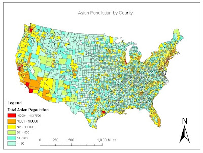
 This map shows the population of Asians in each county. From the map, we can see that a lot of the population is in the southwest. There is a very small population in the middle of the United States. One thing that is interesting is that there is one county in Texas with over 100,000 while the rest of the state has a fairly low population. A similar thing is seen in Chicago as compared with other counties in the midwest.
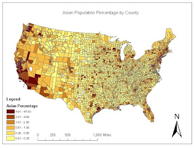
This map shows the population percentage of Asians in each county. This is the number of Asians divided by the total population. Again, there is a higher percentage of Asians in the southwest. While there are higher percentages in the middle of the US as compared to the population map, but it's important to notice that the highest range is over 4%. However, for the most part, the percentages follow the population map fairly closely.
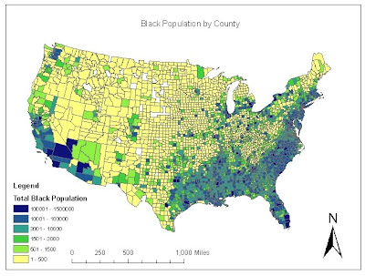 This map shows the black population across the continental United States. From this graph, you can see a larger number of blacks in the southern regions the the United States as compared to the rest of the country. However, there are other parts of the country with a fairly high population, such as Detroit, Buffalo, and Chicago.
  This map shows the black population density in the continental United States. In order to calculate this value, I had to take the black population and divide it by the county area. Once this column was determined, then I was able to map it. While the population map showed a large number in the south, the density map doesn't show as significant numbers in that area. However, in most other areas that had a high population, there was also a large population density as well.
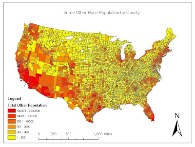 This map shows the population for "Some Other Race" across the United States. This shows that a large number of people in this group are in Southern California and Arizona, with some on the southern tip of Florida. Most counties across the US have less than 300.
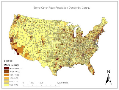
For this series of maps using census data, I found it much easier to make maps of the population rather than the density and percentage maps. The population maps had a better gradient that allowed the maps to have many counties with each color in the range. Also, I found that the population maps do not always reflect what the other maps will look like. While some had a direct correlation, other maps different greatly as compared to the population map. This lab was very helpful in creating applicable maps using accessible source data found online.
My overall impression of GIS is that it is a very powerful tool and it allows people to portray the information they want to show. There is a large amount of information that GIS can display and the programs used are very user friendly. Using ArcGIS, I found that while sometimes the steps are not completely obvious, once the user learns the tools, they can easily display any information they would like. In addition, there are many sources online that allows users to access the information and makes any information readily available for anyone wanting to use GIS.


